Trail Running at the End of the World - Dientes de Navarino
Our first post on sóijen! And what better way to inaugurate our new blog then to write about our latest adventure at the end of the world.
Background
- Trek: Los Dientes de Navarino circuit
- Total Distance: 50 km (42 km trails, 8 km dirt road)
- Location: Isla Navarino, Chile (see map below)
- Closest City: Puerto Williams
- Duration: (?)
The duration is a best described by a question mark because it depends on what type of experience you are looking for. The trek is traditionally done as a 3-5 day backpacking trip. Our style was to go ultralight and complete it in one day.
The Challenges
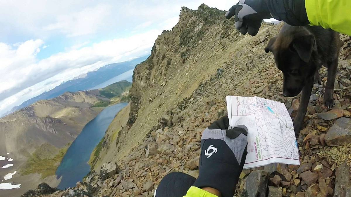
- Route Finding: The trail has 38 official markers and is otherwise indicated only by cairns, which can be difficult to follow due to the rocky terrain.
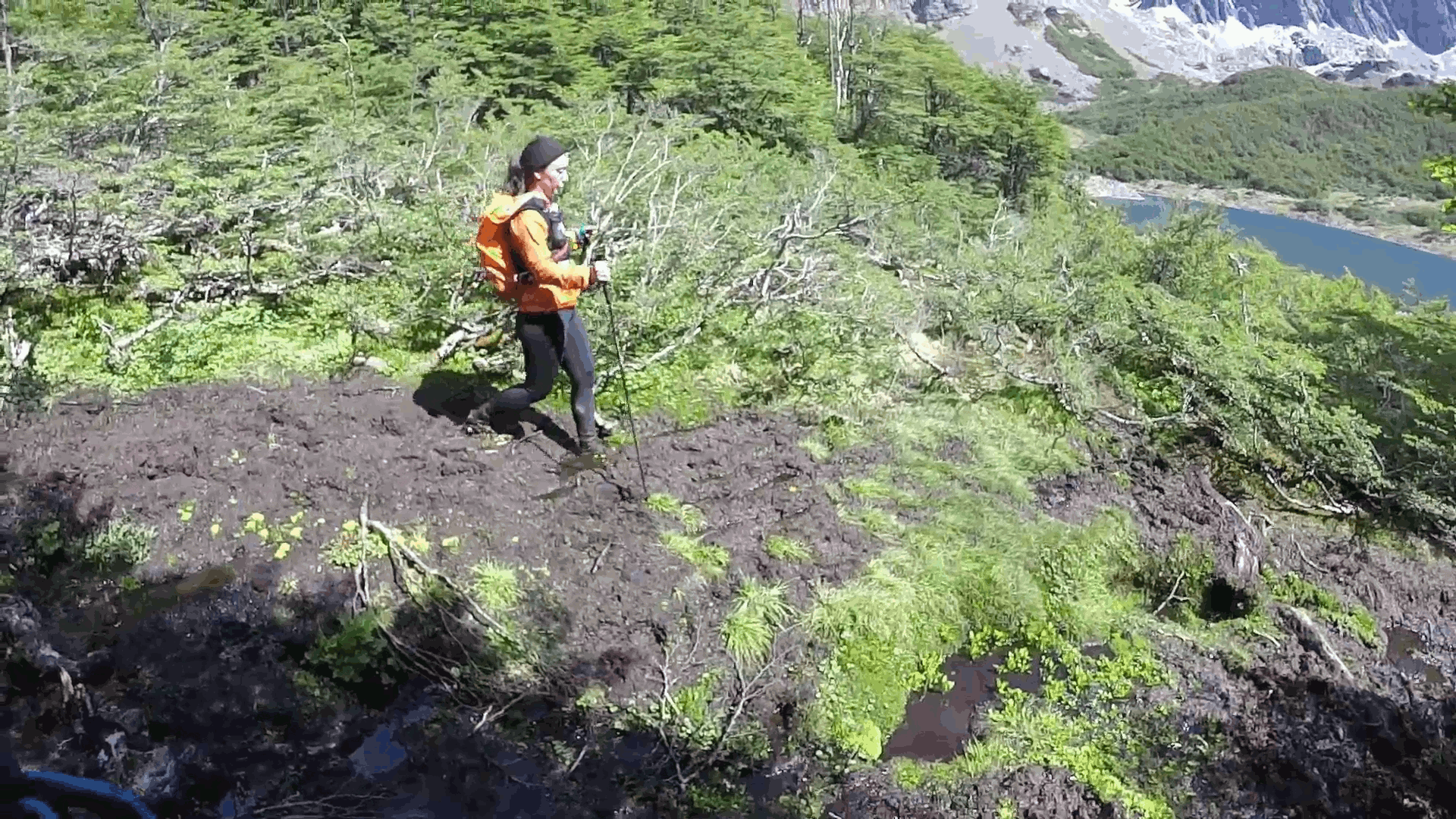
- Mud: Infamous Patagonian turba (peat), especially in the second half of the circuit.
- Weather: This is Patagonia. You can experience all four seasons in one day.
Our Experience
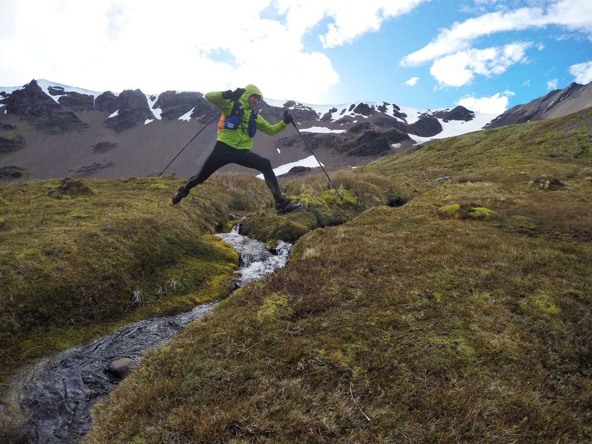
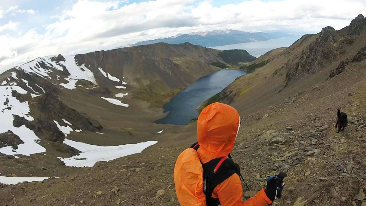
We began the circuit at 5:20 AM on December 8, 2016 from Plaza de la Vírgen in Puerto Williams. We chose the route up Cerro Bandera (on the left) and followed it until Laguna del Salto. What’s impressive about this trek is how drastically the landscape changes. After Laguna del Salto, we ascended and hit snow in Paso Primero and then Paso Australia. The traverse was incredibly beautiful but the route finding difficult as we tried to find the next cairn while sometimes knee deep in snow.
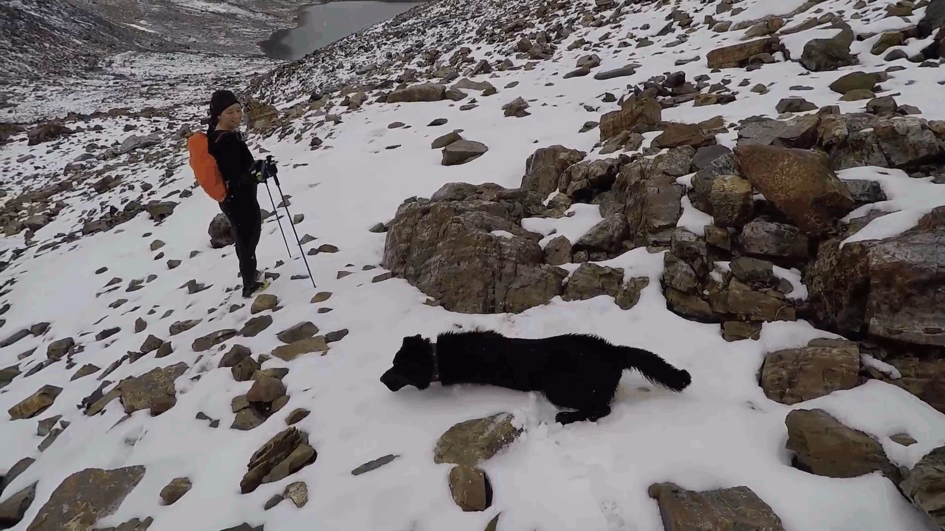
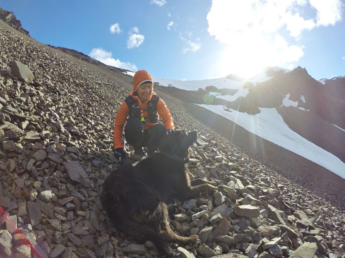
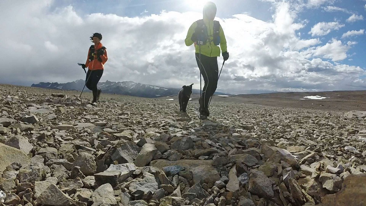
As we reached the third snowy mountain pass – Paso de los Dientes – we integrated a new member to our team. “Navarino” appeared out of nowhere, but what a welcome surprise! Who would expect a dog to suddenly appear in the middle of the mountains?
Navarino quickly became not only the third teammate in our adventure, but our trail angel. Although the weather cleared behind Los Dientes and we trekked under blue skies, the route was difficult to follow. But Navarino, our guide, knew exactly where to go. We redistributed our food for three and took more frequent breaks to give Navarino some love and encouraging hugs.
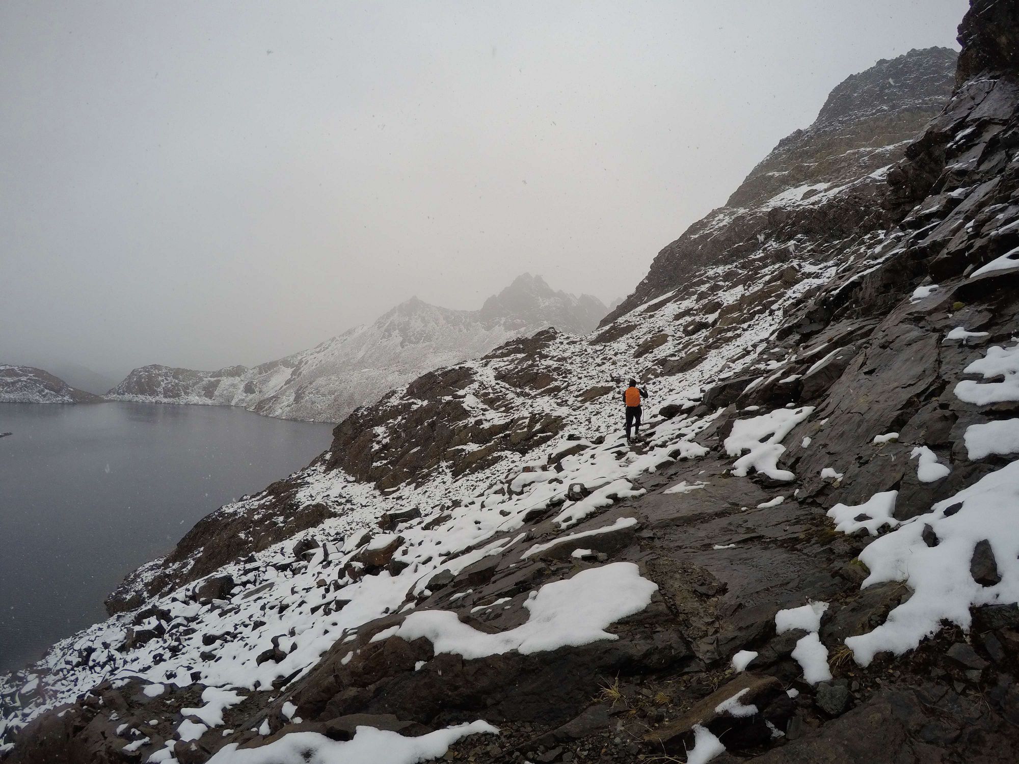
The one time we felt real fear on the trail was when we reached Paso Virginia, the highest point on the trail (844 meters). The ascent was tough – muddy, then rocky, and always steep. But the descent was nerve-wracking. The “trail” that continued was a straight line down the side of the mountain. We were scared for ourselves, and more so for Navarino, but the brutal winds on the mountain ridge didn’t give us much time to think it over. Down we went, digging our heels into the sand and scree.
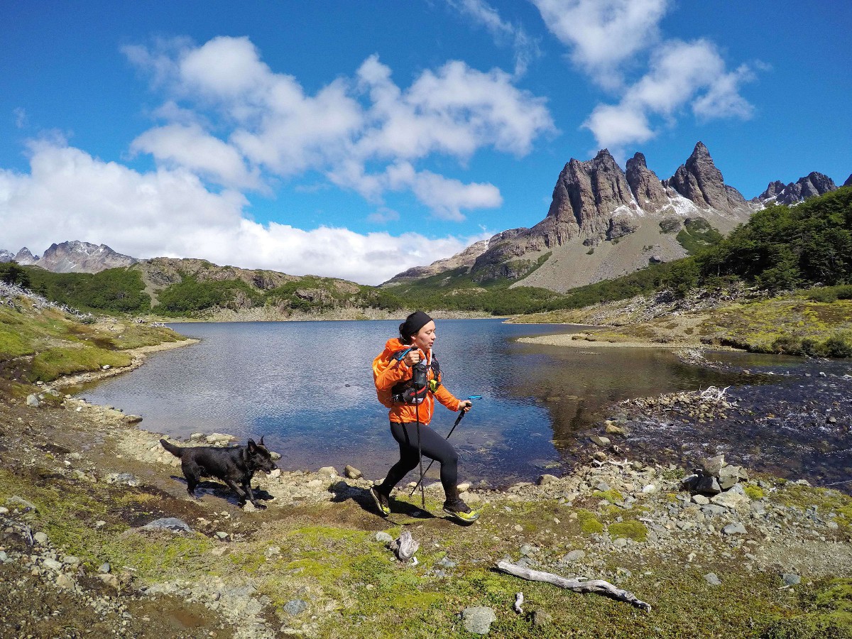
The last leg of the circuit was the most challenging. Tired legs (and paws) and tired minds, and an almost nonexistent trail. Again with Navarino’s help we eventually made it back to the road, and the final 8 km leg back to Plaza de la Vírgen. We arrived at 10:30 PM, just as darkness hit. And as we walked through the streets of Puerto Williams, Navarino vanished just as suddenly as he appeared in our lives.
Recommendations
- Register your trekking plans before you leave with the Carabineros (police) located in Puerto Williams.
- Purchase a trekking map in town (~4000 CLP). We got ours from Turismo Aventura Shila.
- Download the GPS waypoints to your watch/GPS device. The map is not enough. Also study up on the route description published by the Ministerio de Bienes Nacionales.
- Plan your trip in the late spring/summer to maximize the daylight hours, especially if you plan to do the circuit in one push. During our trip we had sunlight between 4:30 AM - 10:30 PM.
- Trekking poles a must! Much of the route involves ascents/descents in rocky terrain.
- Gaiters are helpful, especially for the extremely muddy areas (ie the second half of the trek).
- Don't forget sunblock and sunglasses, even if it is cloudy.
- There is plenty of water on route so carrying a liter at a time should be more than enough. There is beaver activity in the region so purify water at lower elevations.